
지진Jun 27, 2026, 01:46 AM• 90777 views
Unearthing the Tremors: A Comprehensive Analysis of Seismic Phenomena, Engineering, and Global Mitigation
Introduction to Seismic Phenomena
An earthquake represents one of the most powerful and destructive natural phenomena on Earth, characterized by a sudden and violent shaking of the ground. This shaking is the direct result of a rapid release of energy in the Earth's lithosphere, which creates seismic waves that propagate outward from the source. For millennia, these events have reshaped landscapes, altered the course of civilizations, and driven scientific inquiry into the inner workings of our planet. Understanding earthquakes requires a multidisciplinary approach, blending geophysics, geology, and structural engineering to comprehend how the Earth moves and how humanity can adapt to minimize devastation.
The Foundation of Plate Tectonics
The scientific framework explaining why earthquakes occur is rooted in the theory of plate tectonics. The Earth's outer shell, or lithosphere, is fractured into several large and small rigid pieces known as tectonic plates. These plates float atop the semi-fluid asthenosphere beneath them. Driven by mantle convection currents, these plates are in constant, albeit extremely slow, motion—moving at speeds comparable to the growth of human fingernails. It is at the boundaries where these plates meet, collide, slide past, or pull apart from one another that the vast majority of global seismic activity is concentrated.

Mechanisms of Seismic Waves
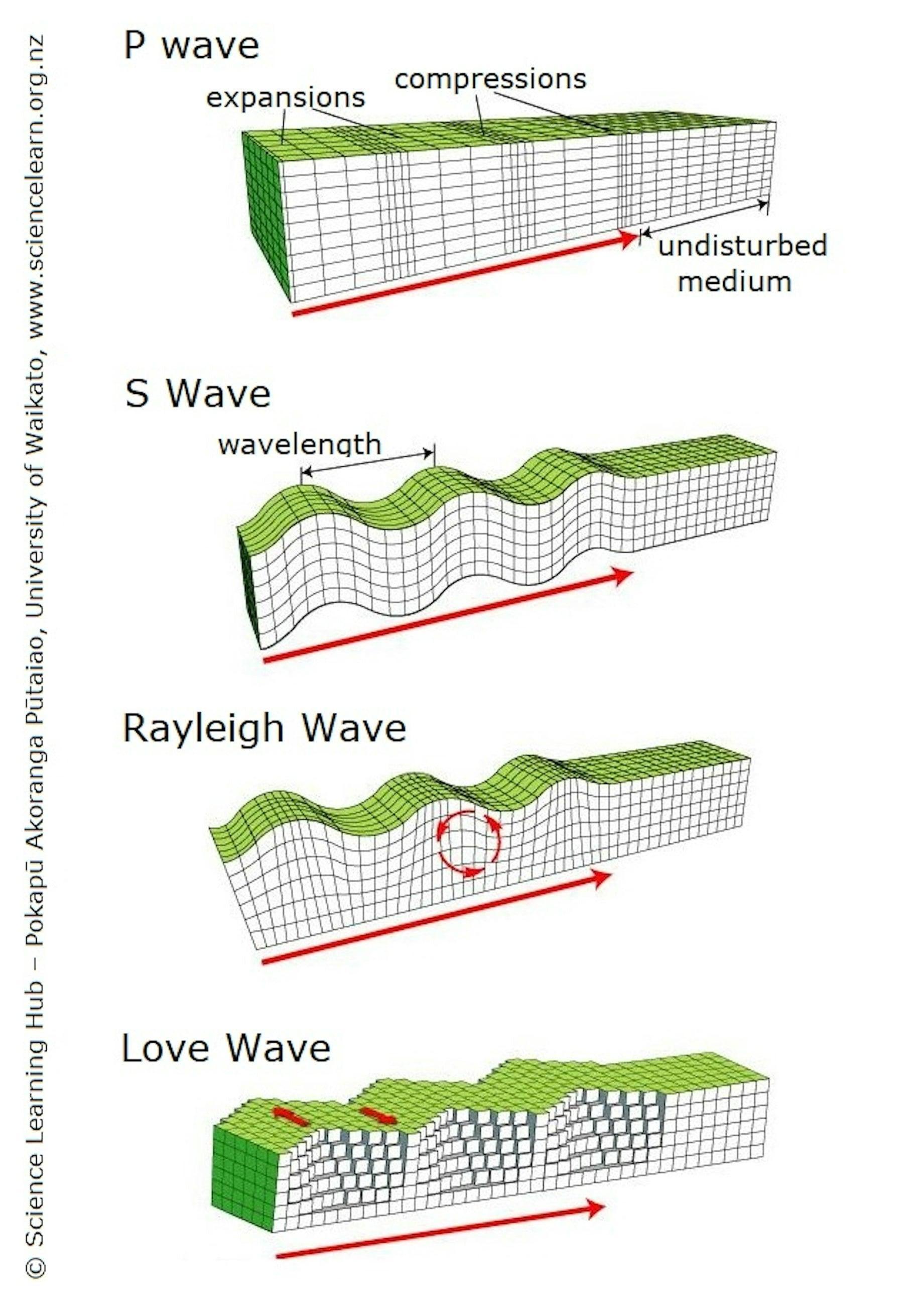
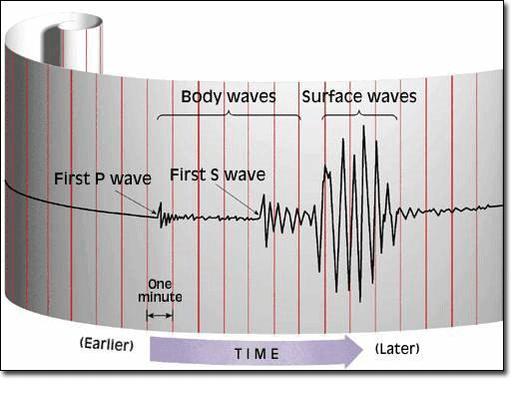
When the stress built up along geologic faults exceeds the frictional forces holding the rock masses together, a rupture occurs, releasing energy in the form of seismic waves. These waves are broadly categorized into body waves and surface waves. Body waves, which travel through the Earth's interior, include Primary (P) waves and Secondary (S) waves. P-waves are compressional waves that move rapidly through both solid and liquid mediums, while S-waves are shear waves that move slower and can only traverse solids. Surface waves, which travel along the Earth's crust, move at even slower speeds but are responsible for the most severe ground displacement and damage during an earthquake.
Quantifying Magnitude: The Richter and Moment Scales
To systematically analyze and compare earthquakes, scientists rely on standardized measurement scales. Historically, the Richter magnitude scale, developed in the 1930s by Charles F. Richter, was the standard for measuring local medium-sized earthquakes. However, modern seismologists primarily use the Moment Magnitude Scale (Mw). Unlike the Richter scale, which measures wave amplitude, the Moment Magnitude Scale calculates the total energy released by assessing the area of the fault rupture, the average amount of slip, and the rigidity of the rocks involved. Because the scale is logarithmic, each whole-number increase represents roughly a 32-fold increase in released energy.
Assessing Destruction: The Modified Mercalli Intensity Scale
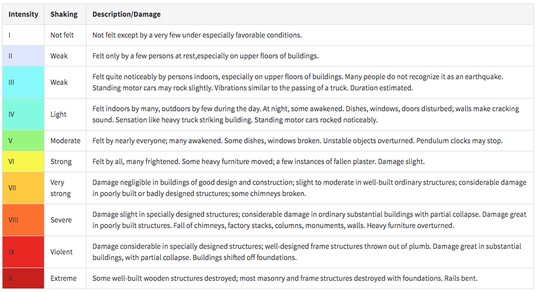
While magnitude measures the physical energy released at the source, earthquake intensity describes the severity of shaking experienced at specific locations on the surface. This is evaluated using the Modified Mercalli Intensity (MMI) scale. The MMI scale uses Roman numerals from I (not felt) to XII (total destruction) based on observed effects on people, structures, and the natural environment. An earthquake has only one magnitude, but its intensity varies dramatically depending on the distance from the epicenter, local soil composition, and structural engineering standards of the affected area.
Anatomy of Faults
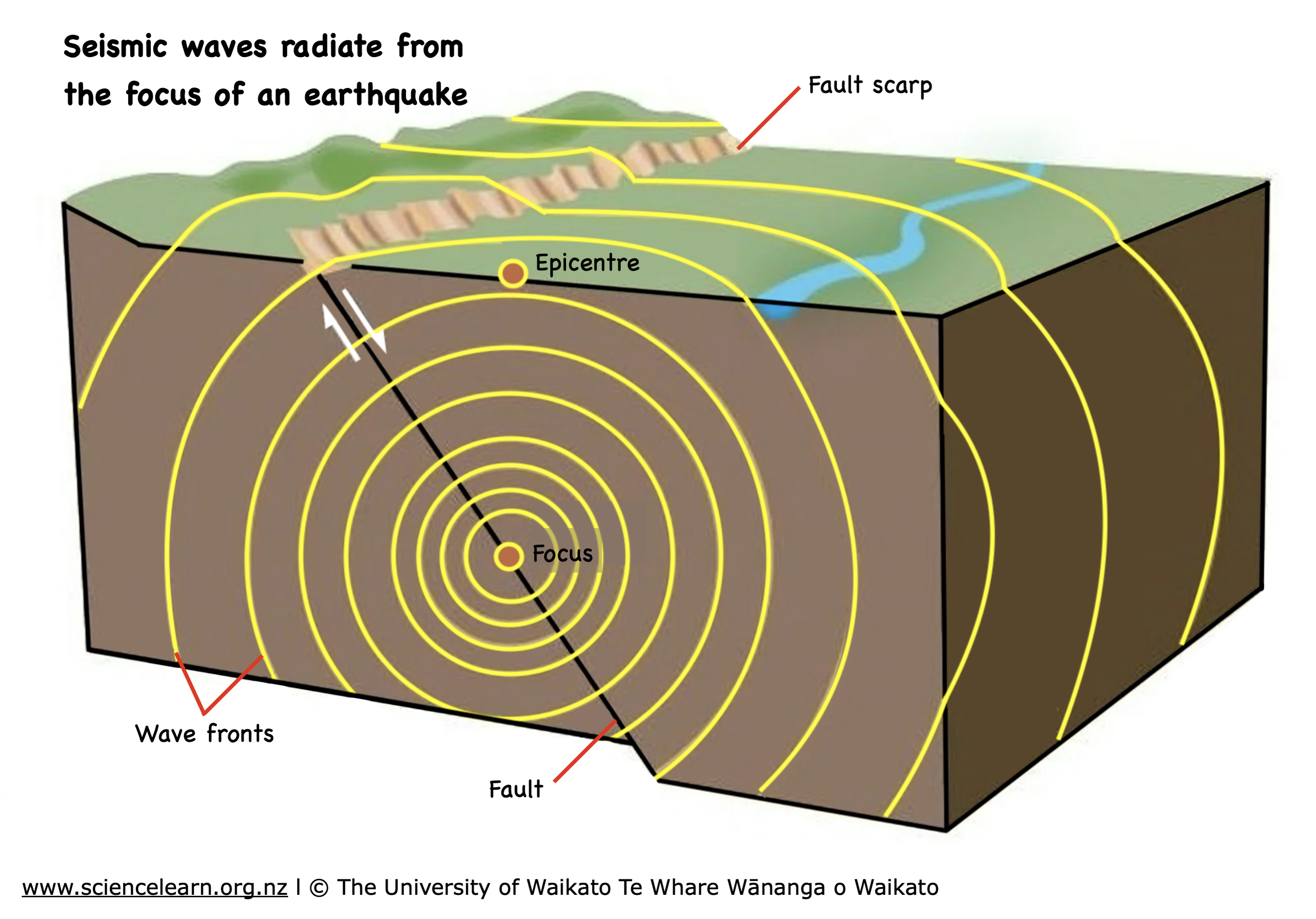
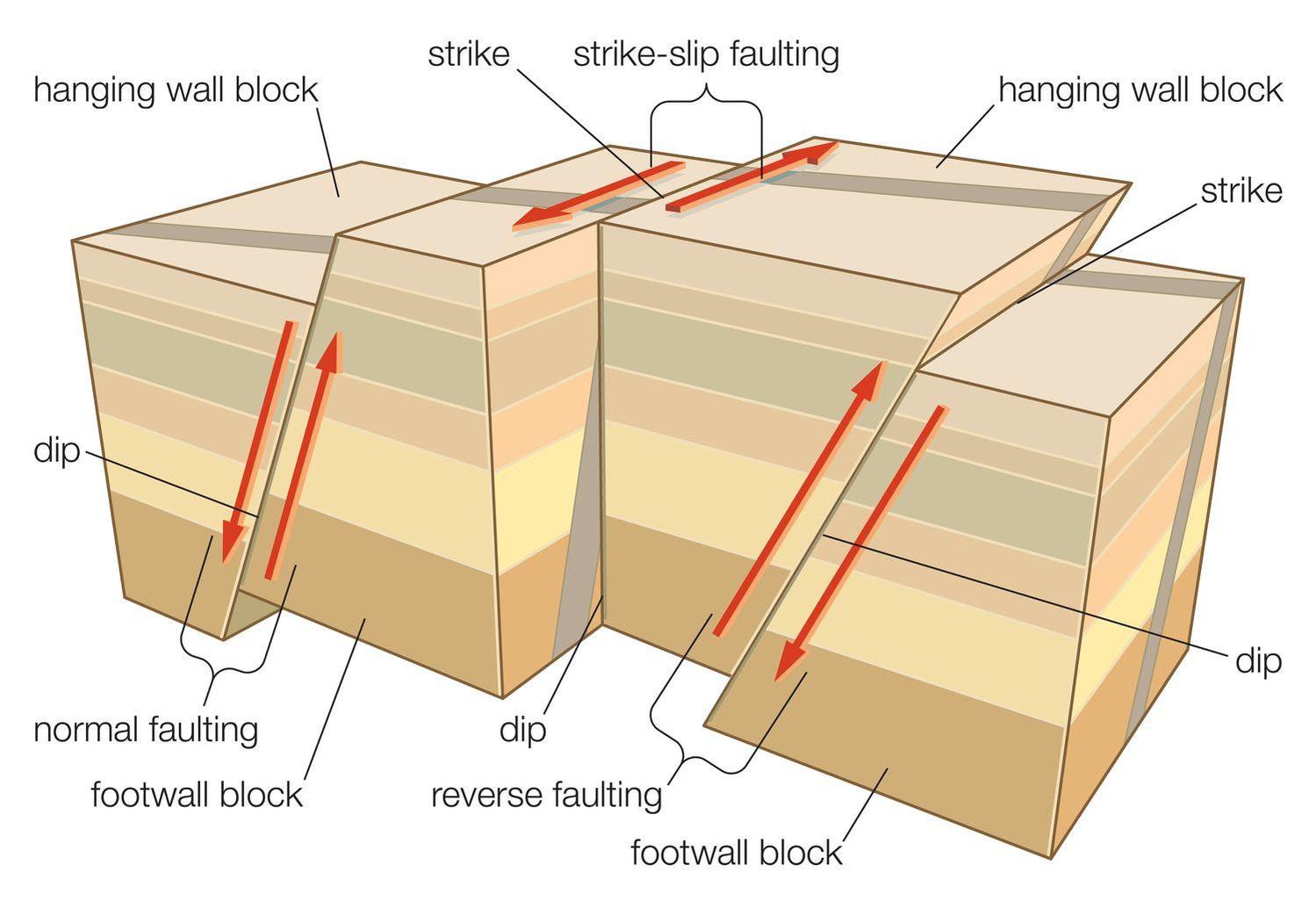
Earthquakes occur along fractures in the Earth's crust known as faults. The nature of the ground displacement determines the fault type. Normal faults occur where the crust is being pulled apart (extensional stress), causing one block of rock to slide downward relative to the other. Reverse or thrust faults occur under compressional forces, pushing one block upward over another, which is common at subduction zones. Strike-slip faults happen when blocks of rock slide horizontally past each other, driven by lateral shear stresses. The infamous San Andreas Fault in California is a classic example of a major strike-slip boundary.
Defining Hypocenter and Epicenter
Two critical terms in seismology are the hypocenter and the epicenter. The hypocenter, also referred to as the focus, is the exact point within the Earth's crust where the initial rupture of the fault begins and the energy is first released. Directly above the hypocenter, on the Earth's surface, lies the epicenter. When news agencies report the location of an earthquake, they are referencing the coordinates of the epicenter. The depth of the hypocenter plays a massive role in the resulting surface destruction; shallow-focus earthquakes generally cause far more severe localized damage than deep-focus events.
The Sequence: Foreshocks, Mainshocks, and Aftershocks
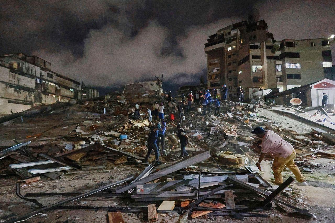
Earthquakes rarely occur in isolation; instead, they often happen in sequences or clusters. The largest event in a sequence is designated as the mainshock. Smaller earthquakes that precede the mainshock in the same geographic area are known as foreshocks, though they can only be identified as such after the larger mainshock occurs. Following the mainshock, a series of smaller earthquakes called aftershocks typically rattle the region. Aftershocks are caused by the crust adjusting to the new stress distribution along the ruptured fault plane, and they can continue for weeks, months, or even years, posing a severe threat to already weakened buildings.

Intraplate Earthquakes: Deep in the Interior
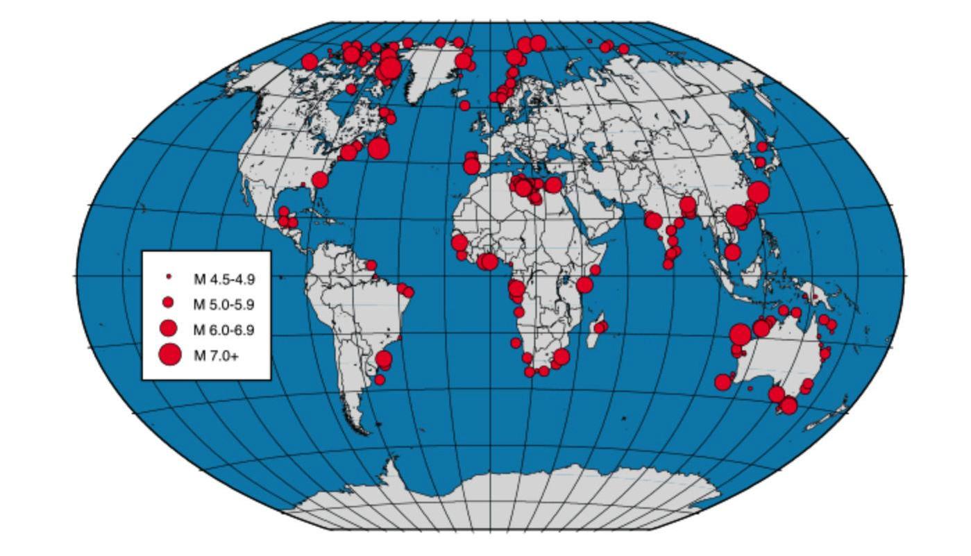
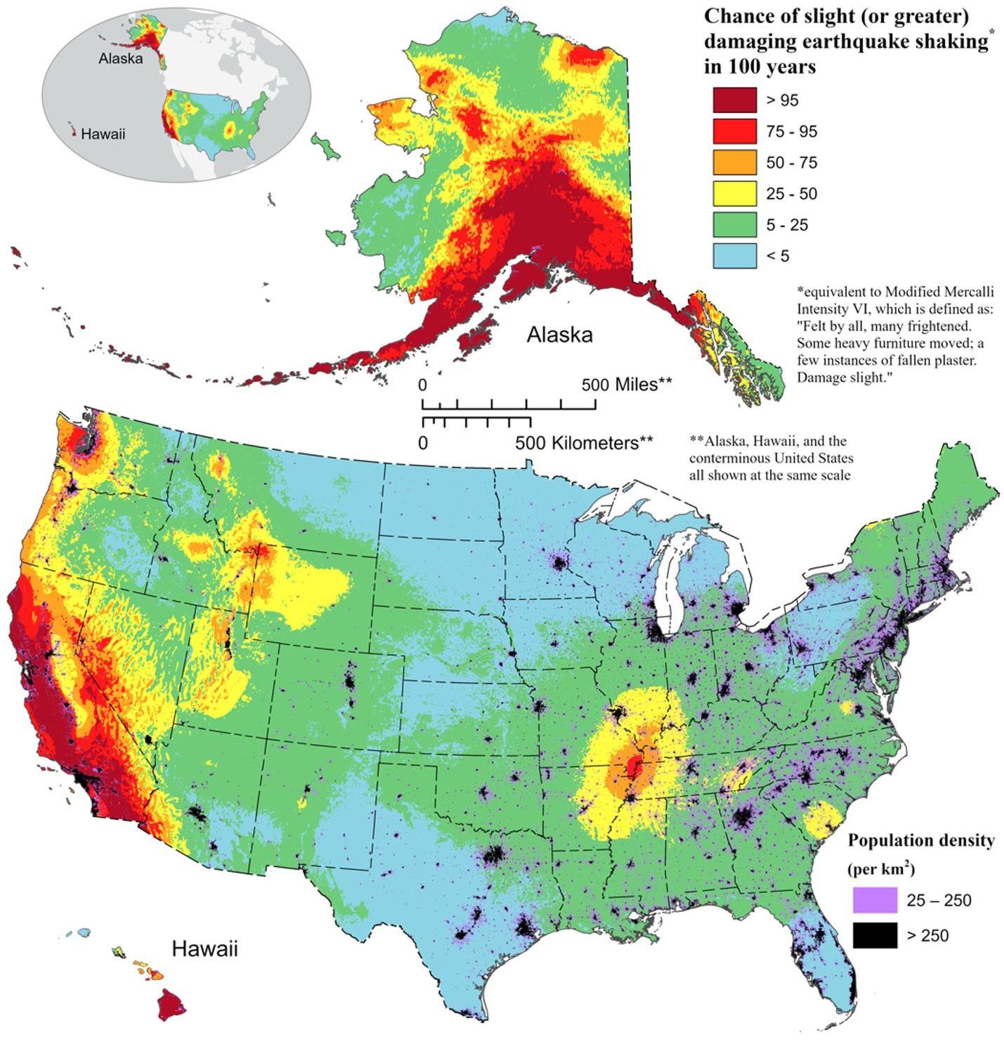
While the vast majority of earthquakes occur at plate boundaries, some of the most surprising and historically devastating events happen far from these edges. Known as intraplate earthquakes, these events occur within the interior of tectonic plates. They are typically caused by ancient, buried fault zones that are reactivated by the distant, ongoing stresses transmitted from plate boundaries. Because these regions are less accustomed to seismic activity, their infrastructure is rarely built to withstand shaking, making intraplate events like the 1811-1812 New Madrid earthquakes in the United States exceptionally hazardous.
Human-Induced Seismicity
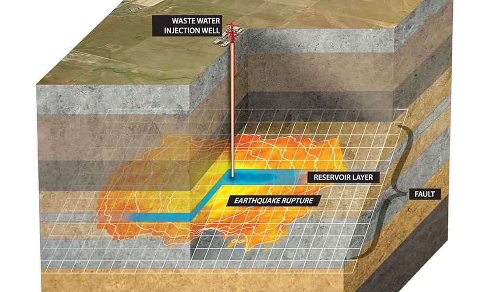
In recent decades, scientists have increasingly documented earthquakes triggered by human activities, a phenomenon known as induced seismicity. Activities such as deep wastewater injection (associated with oil and gas extraction), reservoir-induced stress from building massive dams, geothermal energy development, and mining can alter the pressure of fluids in the subsurface. This fluid pressure can lubricate pre-existing faults, allowing them to slip under tectonic stress that would have otherwise remained locked. Regulators and industries are actively working on monitoring frameworks to mitigate these artificial seismic hazards.
Undersea Earthquakes and Tsunamis
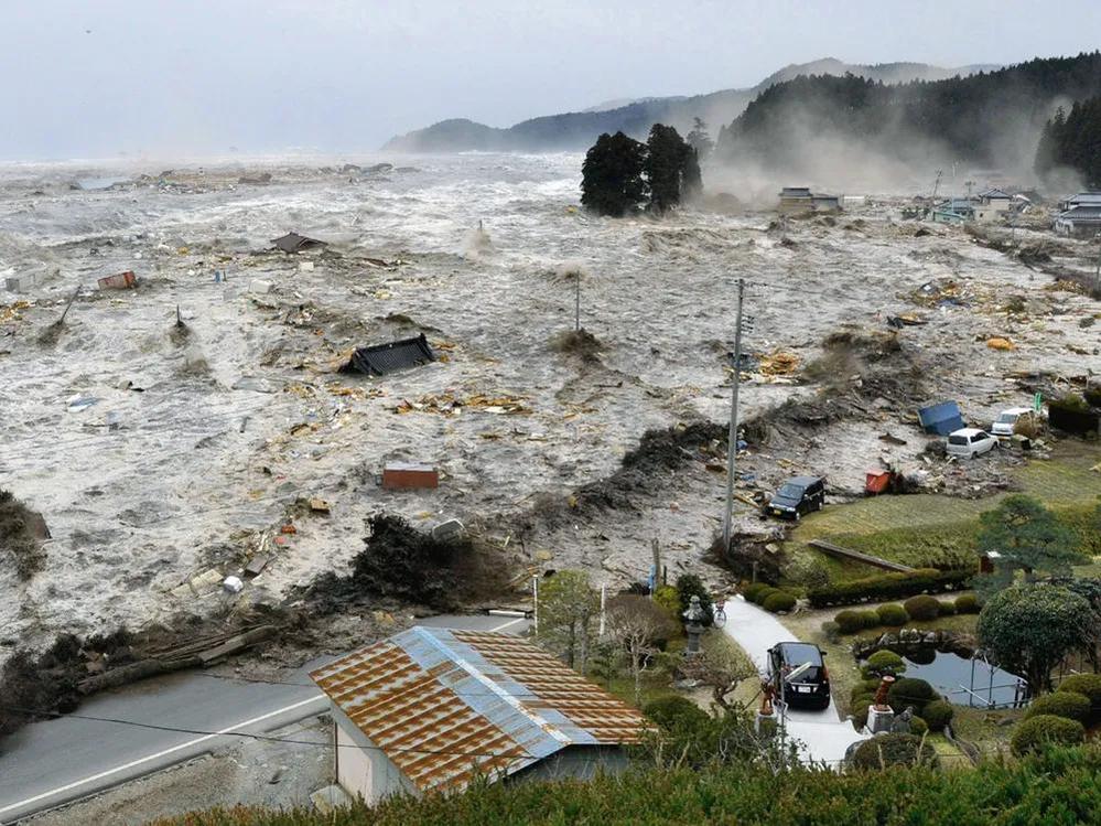
One of the most terrifying secondary hazards of an earthquake is the generation of a tsunami. When a massive earthquake occurs underwater, particularly along subduction zones where one plate thrusts violently beneath another, it can cause sudden vertical displacement of the seafloor. This displacement acts like a giant paddle, lifting the column of water above it. This energy propagates across the ocean in long, low-amplitude waves at speeds exceeding 500 miles per hour. As these waves approach shallow coastal waters, they slow down and grow into towering walls of water, causing catastrophic coastal inundation.
Soil Liquefaction and Ground Failure
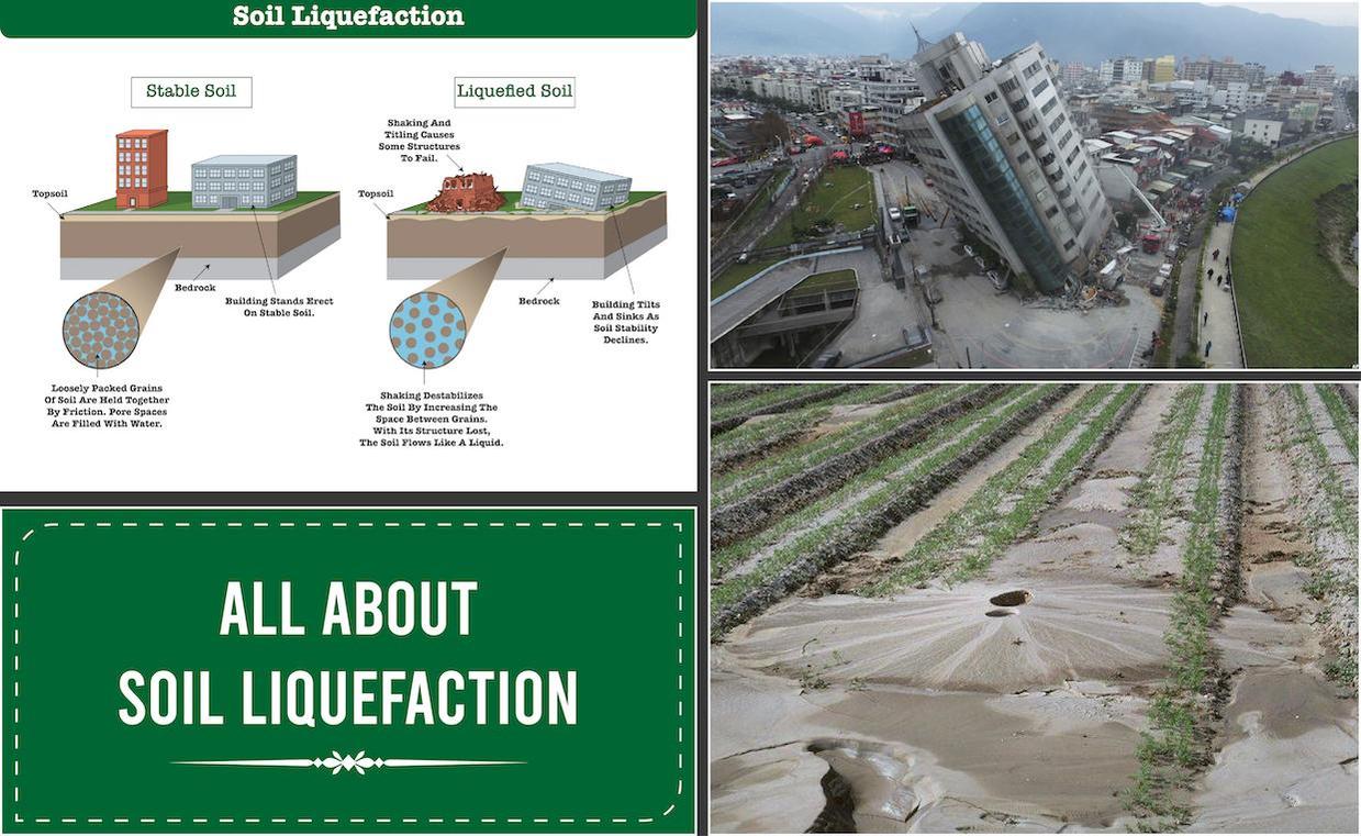
Ground shaking is not the only physical hazard during an earthquake; soil behavior can also change dramatically. Soil liquefaction is a phenomenon where saturated, loosely packed, cohesionless soils lose their strength and behave like a liquid due to rapid, intense shaking. When liquefaction occurs, the water pressure in the soil pores rises to a level where it supports the load instead of the soil particles. As a result, heavy buildings can tilt or sink, underground pipelines can float to the surface, and entire hillsides can give way to massive landslides, compounding the destruction of the initial tremors.
Historical Case Study: The 1906 San Francisco Earthquake
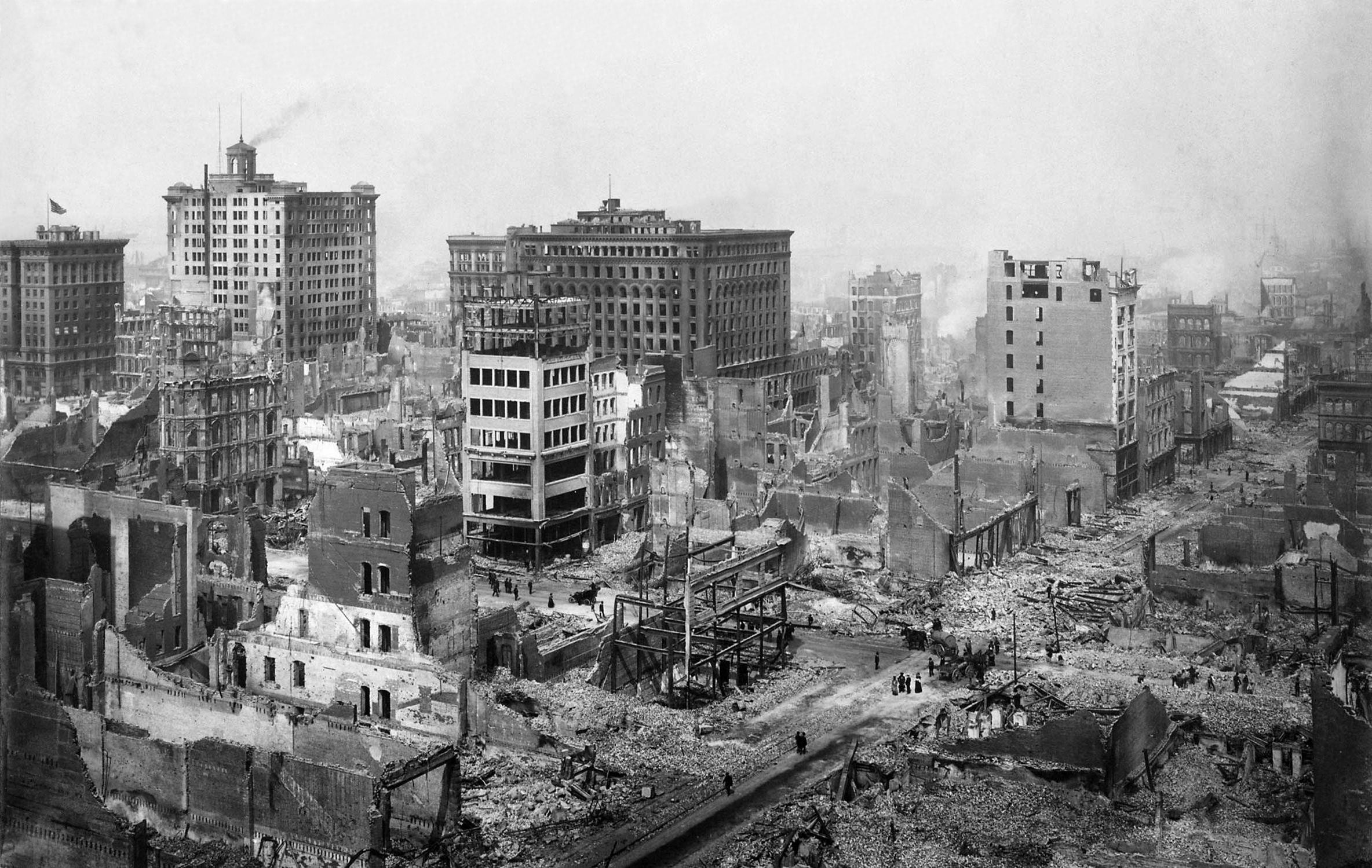
The 1906 San Francisco earthquake stands as a landmark event in the history of seismology and urban planning. Striking the coast of Northern California on April 18, 1906, with an estimated magnitude of 7.9, the rupture along the San Andreas Fault caused widespread devastation. However, the majority of the destruction and loss of life resulted from the massive fires that raged through the city afterward, fueled by ruptured gas lines and unfettered by broken water mains. This disaster forced engineers and city planners to recognize the critical link between seismic events and secondary utility failures.
The 2011 Tohoku Megathrust Earthquake
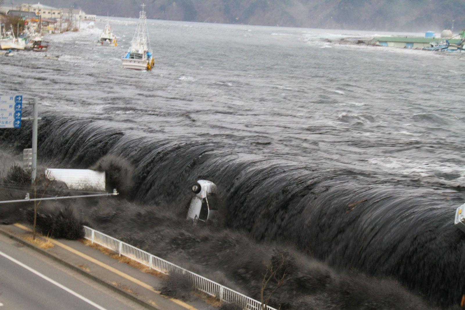
On March 11, 2011, a magnitude 9.0–9.1 megathrust earthquake struck off the Pacific coast of Tohoku, Japan. It was the most powerful earthquake ever recorded in Japan and the fourth most powerful in modern history. The earthquake triggered a monstrous tsunami with waves reaching heights of up to 40 meters, which swept inland, causing widespread loss of life, displacing hundreds of thousands of residents, and triggering the Fukushima Daiichi nuclear disaster. This event emphasized that even highly prepared nations with advanced early warning systems can face unprecedented cascading crises during extreme natural disasters.
Principles of Seismic Engineering
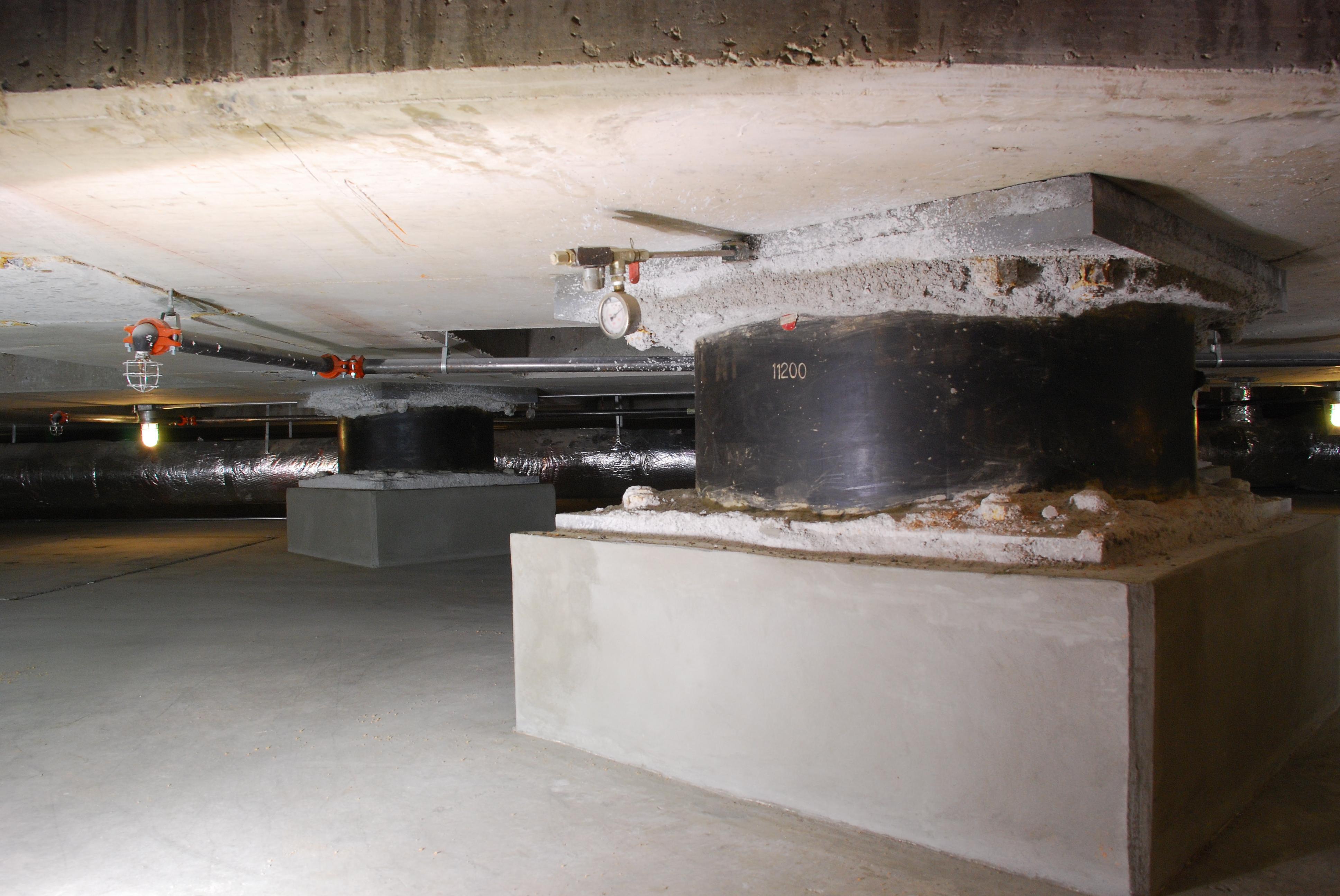
In response to the threat of earthquakes, the field of seismic engineering has evolved to design structures that can survive intense ground shaking. Modern engineering focuses on ductility—the ability of a building to deform plastically without collapsing. Techniques include base isolation, where a building is detached from its foundation using flexible pads or bearings that absorb ground movements, and the installation of tuned mass dampers, which act as giant pendulums inside skyscrapers to counteract lateral sway. These innovations have successfully saved countless lives in seismically active urban zones.
Retrofitting Older Infrastructure
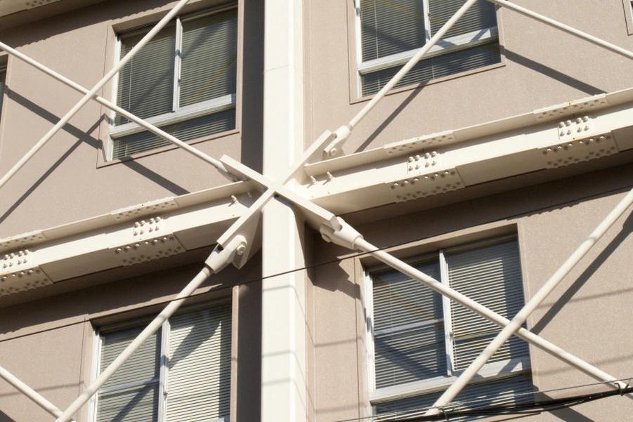
While designing new, earthquake-resistant buildings is highly effective, a significant challenge lies in protecting older, existing infrastructure. Seismic retrofitting involves reinforcing older buildings, bridges, and highways to meet modern safety standards. Common techniques include wrapping concrete columns in steel jackets, adding shear walls to resist lateral forces, and installing diagonal steel bracing. Retrofitting is expensive and logistically complex, but it is an essential public safety investment in older cities built before modern seismic codes were established.
The Evolution of Earthquake Early Warning Systems
While predicting the exact time and location of an earthquake remains impossible, technology has enabled the creation of Earthquake Early Warning (EEW) systems. These systems utilize networks of seismometers placed near known active faults. When an earthquake occurs, the sensors immediately detect the fast-moving, non-destructive P-waves and transmit data via high-speed telecommunications. Computers calculate the earthquake's location and magnitude, sending alerts to cities seconds to minutes before the slower, highly destructive S-waves and surface waves arrive, allowing trains to stop, gas lines to shut down, and people to take cover.

The Science of Earthquake Forecasting vs. Prediction
It is vital to distinguish between earthquake prediction and earthquake forecasting. Earthquake prediction refers to the ability to specify the exact time, place, and magnitude of a future event—a capability that current science does not possess despite decades of research into animal behavior, radon gas emissions, and electromagnetic signals. On the other hand, earthquake forecasting involves estimating the probability of a specific magnitude earthquake occurring within a particular region over a longer timeframe (such as 30 years). These probabilistic models are invaluable for establishing building codes and insurance rates.
Public Preparedness and Emergency Drills
No matter how advanced engineering and early warning systems become, public preparedness remains the cornerstone of minimizing casualties. Initiatives like the "Great ShakeOut" organize annual drills involving millions of people worldwide, practicing the simple yet lifesaving protocol: "Drop, Cover, and Hold On." Governments and safety organizations also stress the importance of securing heavy furniture, creating household emergency plans, and maintaining disaster supply kits containing water, food, first aid, and basic communication tools to survive the critical first 72 hours following a major disaster.

The Future of Seismology: AI and Global Monitoring
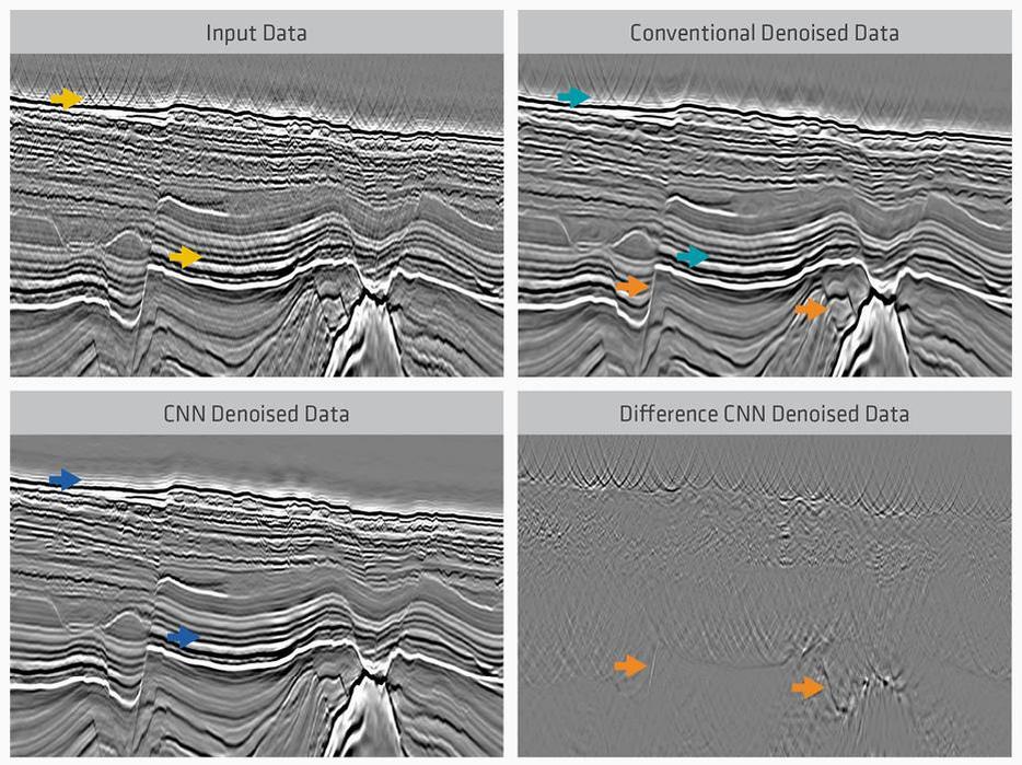
The future of seismic research is rapidly evolving with the integration of artificial intelligence and machine learning. Seismologists are training deep learning algorithms on massive historical datasets of seismic signals, allowing for faster and more accurate detection of micro-earthquakes that might otherwise go unnoticed. Furthermore, global monitoring is becoming more collaborative, utilizing satellite-based Interferometric Synthetic Aperture Radar (InSAR) to measure subtle ground deformations from space. As technology continues to advance, our ability to monitor, analyze, and mitigate the risks of these powerful planetary movements will only improve, building a more resilient world.
#earthquake#seismology#plate tectonics#natural disaster#seismic engineering#tsunami#earthquake preparedness#geophysics
Comments(0)
No comments yet. Be the first to share your thoughts!
Recommended Reads
 Kbeauty
Sep 22, 2026, 10:03 PM
Target Beauty Studio: How K-Beauty is Conquering the American Mass Market
On September 10, 2026, retail giant Target officially launched Target Beauty Stu...
 Skincare
Sep 21, 2026, 10:03 PM
How K-Beauty is Powering Global Ingredient Literacy and Redefining Skincare
In a major move for the global beauty industry, Korean-American cosmetics brand ...
 JayPark
Sep 20, 2026, 10:06 PM
Edmonds-Born K-Pop Pioneer Jay Park Set for Major Seattle Homecoming Concert
Edmonds-born K-pop and hip-hop pioneer Jay Park is returning to his roots for a ...
 BTS
BTSSep 19, 2026, 10:04 PM
The Triumph and Autonomy of BTS: Inside Their Historic 2026 Comeback and Bold Grammy Boycott
After a scheduled hiatus that began in late 2022, the global supergroup BTS has ...
 Fitness Gaming
Sep 3, 2026, 03:35 AM
VXROOM: Transforming Daily Workouts into Engaging Web-Based Motion Games
VXROOM (vxroom.com) is an innovative web-based int...
 Survival Show
Sep 1, 2026, 09:07 AM
Game of Blood X: The Evolution of Korea’s Fiercest Survival Reality Franchise
Wavve's hit original series Game of Blood ...